
Contents
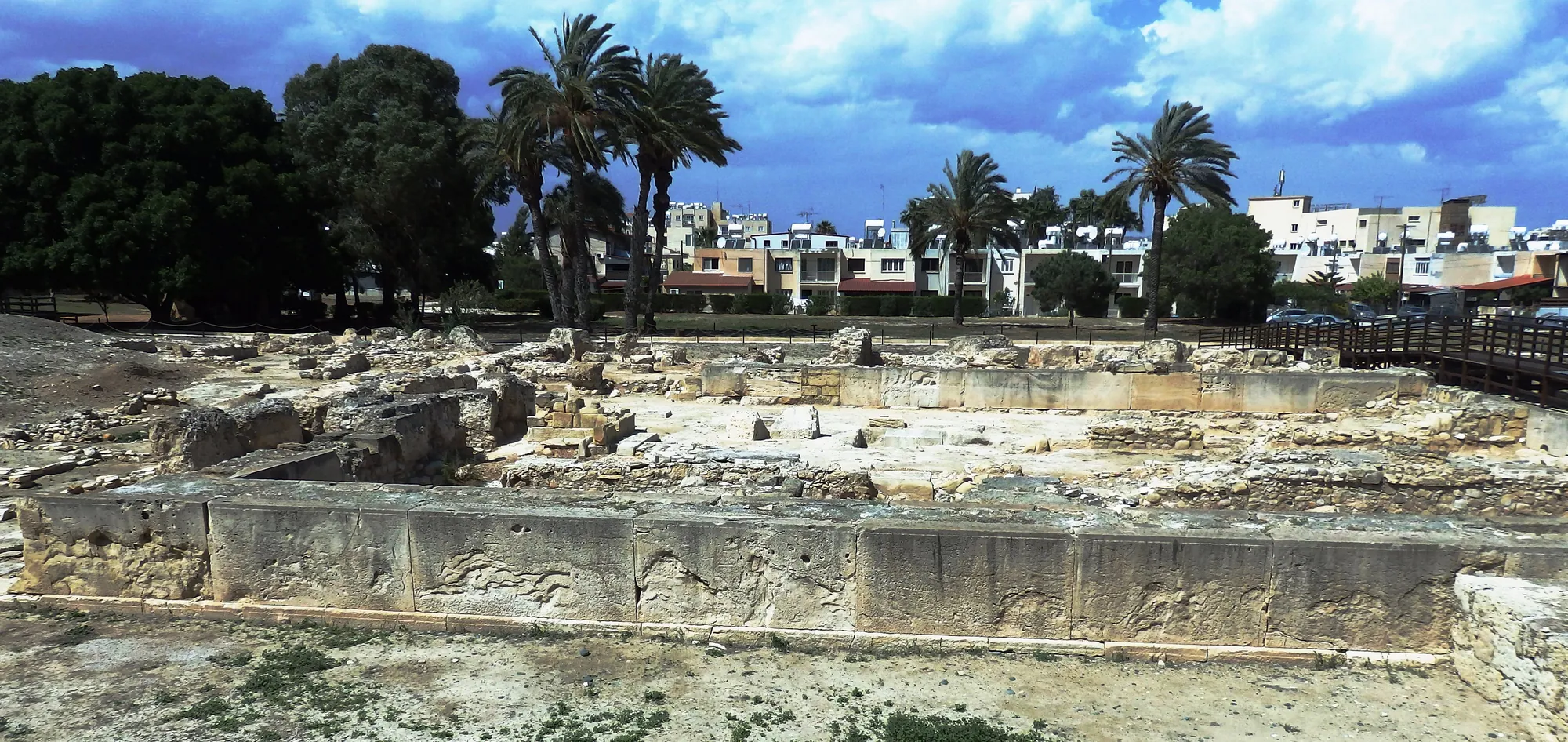
Kition was the ancient city on the south-east coast of Cyprus whose remains lie beneath the centre of modern Larnaca. It was founded as a harbour town in the 13th century BC, in the Late Bronze Age, and its sacred quarter at Kathari, with five temples, a city wall and copper workshops that opened into the temple courts, is the part of the ancient city that visitors can see today [1, pp. 65–77]. After a gap of about a century and a half the Phoenicians rebuilt the largest of the temples for the goddess Astarte [1, p. 175]. In the 5th and 4th centuries BC Kition was the seat of a Phoenician dynasty that took over Idalion and Tamassos and kept a war harbour of ship sheds at Bamboula [2, pp. 169–200]. Ptolemy I put its last king to death in 312 BC, but the city lived on, and Zeno, the founder of Stoic philosophy, was born there [3].
The city and its parts
Kition lies under houses, streets and public gardens, and almost everything known of it comes from plots kept free of building or from rescue work ahead of construction. The excavated parts are scattered across the modern town. Three of them matter most on this page:
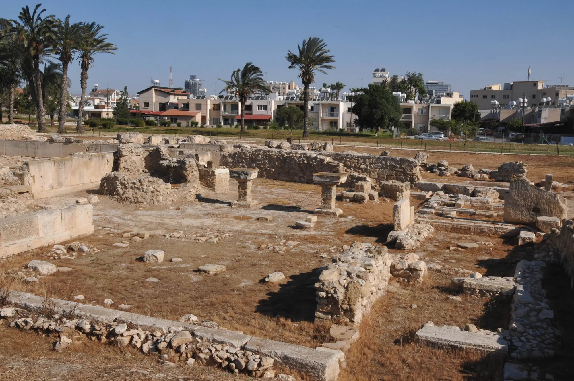
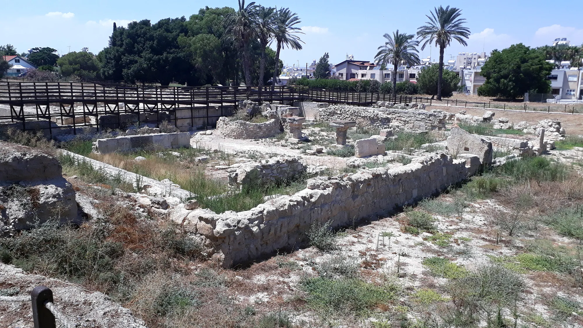
- Kathari (Area II), in the north of the ancient city, beside its northern wall: the sacred and industrial quarter excavated by the Department of Antiquities. It is the area open to visitors.
- Chrysopolitissa (Area I), a small residential quarter of the Late Bronze Age town with built tombs in the courtyards of its houses [4].
- Bamboula, a low mound in the east of the city, about 500 m from Kathari, near the Larnaca District Museum. It held the Phoenician sanctuary of Astarte and Herakles-Melqart and, on its north side, the war harbour [2, pp. 55–66].
The cemeteries lay around the city, and several of their localities, such as Ayios Prodromos, Pervolia and Kamelarga, have their own entries in our register of sites; they are separate places, not other names for Kition. Between the mound of Bamboula and the present shore lay the ancient harbour, which silted up into a marsh [5]. Early travellers could still see where it had been [1, p. 23]. Nineteenth-century writers called Bamboula the "acropolis" of Kition, and the name stuck in the literature. The French excavators found a sanctuary and harbour works on the mound, and no citadel [2, pp. 55–66].
Kition stood in a district with other harbour towns. Hala Sultan Tekke, a large Late Bronze Age town on the shore of the Larnaca Salt Lake, lies about 6 km to the south-west, and the Late Bronze Age settlement of Pyla-Kokkinokremos to the north-east. Inland, the Phoenician kings of Kition later ruled Idalion and Tamassos.
Map of Cyprus
- Ground above 200, 500, 1,000 m
Discovery and excavation
As early as the 18th century travellers wrote of ancient remains "daily dug up all round" Larnaca, and they admired the size and finish of the squared stones [1, p. 23]. In 1845 a stele of the Assyrian king Sargon II, recording the submission of the kings of Cyprus and set up at Kition in 707 BC, came to light by chance in Larnaca; it is now in the Vorderasiatisches Museum in Berlin [1, p. 23; 6]. It is usually said to have been found on the Bamboula mound, but Merrillees has argued that it more probably came from the city wall, or beside it, near the church of Phaneromeni [7, p. 349].
The heaviest damage came in 1879, a year after the British took over the administration of the island. The Bamboula mound was cut down and its earth used to fill the marshes by the shore, under the supervision of Lieutenant Hugh Sinclair of the Royal Engineers [8]. Vassos Karageorghis called it "by far the most disastrous" operation the site has suffered [1, p. 21]. Sinclair's report describes a wall of "very good ashlar masonry" about 10 feet high that "stopped abruptly", masses of squared stone "in astonishing confusion", layers of ash and pottery, and two pierced stones that he took for mooring stones for ships [1, p. 22]. A selection of the finds went to the British Museum, among them the inked plaque with the accounts of the temple of Astarte [1, pp. 22–23; 8]. The 1879 finds in London were catalogued by Thomas Kiely and Sabine Fourrier in 2012 [8].
In 1913 John Linton Myres dug on the so-called acropolis and found nothing earlier than about 1000 BC except for one "Late Minoan" sherd. He concluded that there had been no important Late Bronze Age town at Kition [1, p. 21]. The Swedish Cyprus Expedition returned to Bamboula in October 1929: Alfred Westholm, digging for Einar Gjerstad, set out to date the Phoenician settlement by stratigraphy, and after only three days struck a large deposit of votive sculpture. He extended the trench and worked until April 1930 [5]. No inscription named the god of the sanctuary, but several of the statues show Herakles-Melqart [5]. The results appeared in 1937 [9].
The Late Bronze Age town was found in the end by accident. A tomb of the Early or Middle Bronze Age came to light near the church of Ayios Prodromos in 1957 [1, p. 23], and from 1959 Karageorghis and the Department of Antiquities excavated Area I at Chrysopolitissa and then the large sacred quarter of Area II at Kathari, into the early 1980s. The work was published in the series Excavations at Kition, with a general account in 1976 [1], the final report on the Bronze Age levels of both areas in 1985 [4] and a volume on the Phoenician and later levels [10].
In 1976 a French mission led by Marguerite Yon, later by Sabine Fourrier, began work at Bamboula and published its results in the series Kition-Bamboula [2, pp. 55–66]. In 1987 it formed the hypothesis that a group of long parallel walls north of the sanctuary belonged to boat sheds; it excavated them systematically from 1989 to 1999 and found the last of them in 2021 [2, pp. 69–150]. In 1990 the mission found, north of Bamboula, the base of a trophy set up by King Milkyaton with a Phoenician royal inscription [11].
Phases of the city
Phases
- Early tombsEarly and Middle Bronze Age
Tombs near Ayios Prodromos, north-west of the later city. No settlement of this date has been found.
- Foundation (Floor IV)13th century BC, Late Cypriot IIC
A walled town with small temples (2 and 3) and tombs in house courtyards. Wells cut to bedrock at Bamboula.
- Rebuilding (Floors IIIA and III)end of the 13th and 12th century BC, Late Cypriot IIIA
Cyclopean city wall, ashlar Temple 1, the temene, copper workshops beside the temples.
- Last Bronze Age town (Floors II and I)12th to early 11th century BC
Continued use without major rebuilding; possible natural destruction at the end of Floor II.
- Abandonment of Kathariabout 1000 to about 850/800 BC
No floors in the sacred quarter; a sanctuary at Bamboula from the 9th century BC.
- Phoenician temple of Astarte9th or 8th century to the 4th century BC
Temple 1 rebuilt on its old foundations; several rebuildings.
- Kingdom of Kition5th century to 312 BC
A Phoenician dynasty rules Kition, then Idalion and Tamassos; ship sheds at Bamboula from the early 4th century BC.
- Ptolemaic and Roman city312 BC to the Roman period
The ship sheds are rebuilt in the early 3rd century BC; the harbour basin is filled in Roman times.
The Bronze Age sequence was worked out at Kathari, where the excavators numbered the floors from the top down, Floor IV being the oldest. The same series of floors was recognised in Area I [4]. The excavators also gave the floors absolute dates; Floor IV begins about 1300 BC in every scheme, but the later dates differ between publications, and the pottery is the firmer guide. Floor IV belongs to Late Cypriot IIC, Floor III to Late Cypriot IIIA, with Late Helladic IIIC (Mycenaean IIIC) pottery, and Floor I to the beginning of the Iron Age, when White Painted I ware predominates [4].
The Late Bronze Age town
Kition was founded in the 13th century BC. Area I fixed the date for the Department's excavators, and the French excavations at Bamboula later reached floors and wells cut into bedrock of the early 13th century [2, pp. 55–66]. In Area I the houses had built chamber tombs in their courtyards. The richest, Tomb 9, held two layers of burials; the later of them is dated by its pottery to the very beginning of the last quarter of the 13th century BC [1, p. 63]. Tombs 1 and 9 together held twelve faience vessels, juglets, bowls, flasks and a pyxis, which may have been made in Egypt or in western Asia [12].
Late in the 13th century the quarter was rebuilt. Karageorghis read the new style of building and the new Mycenaean-style pottery that came with it as the work of Achaean Greek settlers, who robbed the older tombs in the courtyards as they built; only Tomb 9, with its collapsed roof, escaped them [1, p. 63]. The idea of a Greek colony has since lost ground. The new ashlar masonry has its closest parallels at Enkomi and at Ras Shamra on the Syrian coast [1, p. 67], and the imports and faience from the tombs show contacts with Egypt and the Levant as much as with the Aegean [12].
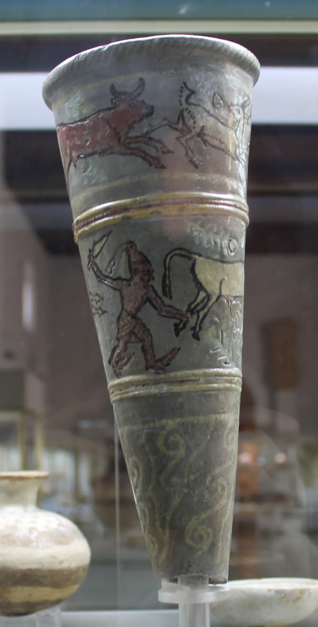
The best-known object from Area I is a conical faience rhyton found just outside Tombs 4 and 5. Its shape follows an Aegean model, its decoration of hunters with short kilts and tasselled headdresses, bulls, a goat and stylised flowers is Levantine in style, and its technique is arguably Egyptian. Edgar Peltenburg, who published it, suggested that it was made on the Syrian coast or in southern Cyprus [12]. It is in the Cyprus Museum.
The sacred quarter at Kathari
Area II lies against the northern city wall. In the first phase (Floor IV), two small temples stood here, Temple 2 and Temple 3. Karageorghis took rows of small pits cut into the rock between them for the plantings of a "sacred garden" [1]; the final report doubted this, because the pits were sealed by the floors of the next phase [4, pp. 43–44].
The Cyclopean wall
In the rebuilding of Floor III a new city wall was raised on the fallen mud brick of the old one, in the same Cyclopean style as the walls of Enkomi, Sinda and Maa-Palaeokastro, and the rectangular stone bastions of the earlier wall were kept. A stretch of 98 m has been uncovered. Its foundations are two rows of large stones, 2.40 m thick throughout, and three courses of mud brick survive in one place on top of the stone socle, so the upper wall was of sun-dried brick [1, pp. 63–64]. Outside the wall ran a street 3 m wide, its surface hard with gravel and bone; at the time of excavation the ruts of wheels were clearly visible on it [1, p. 65].
Temple 1 and the temene
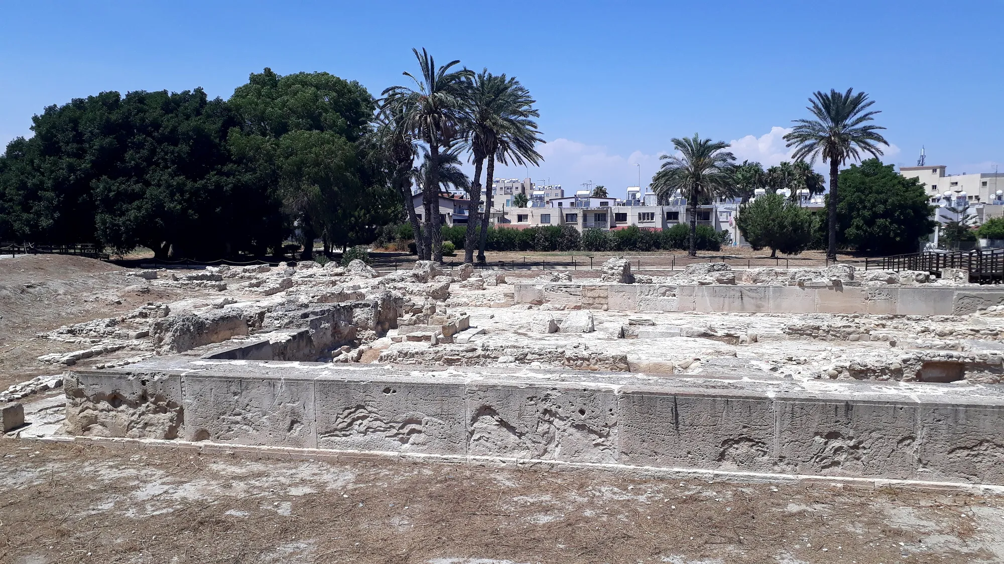
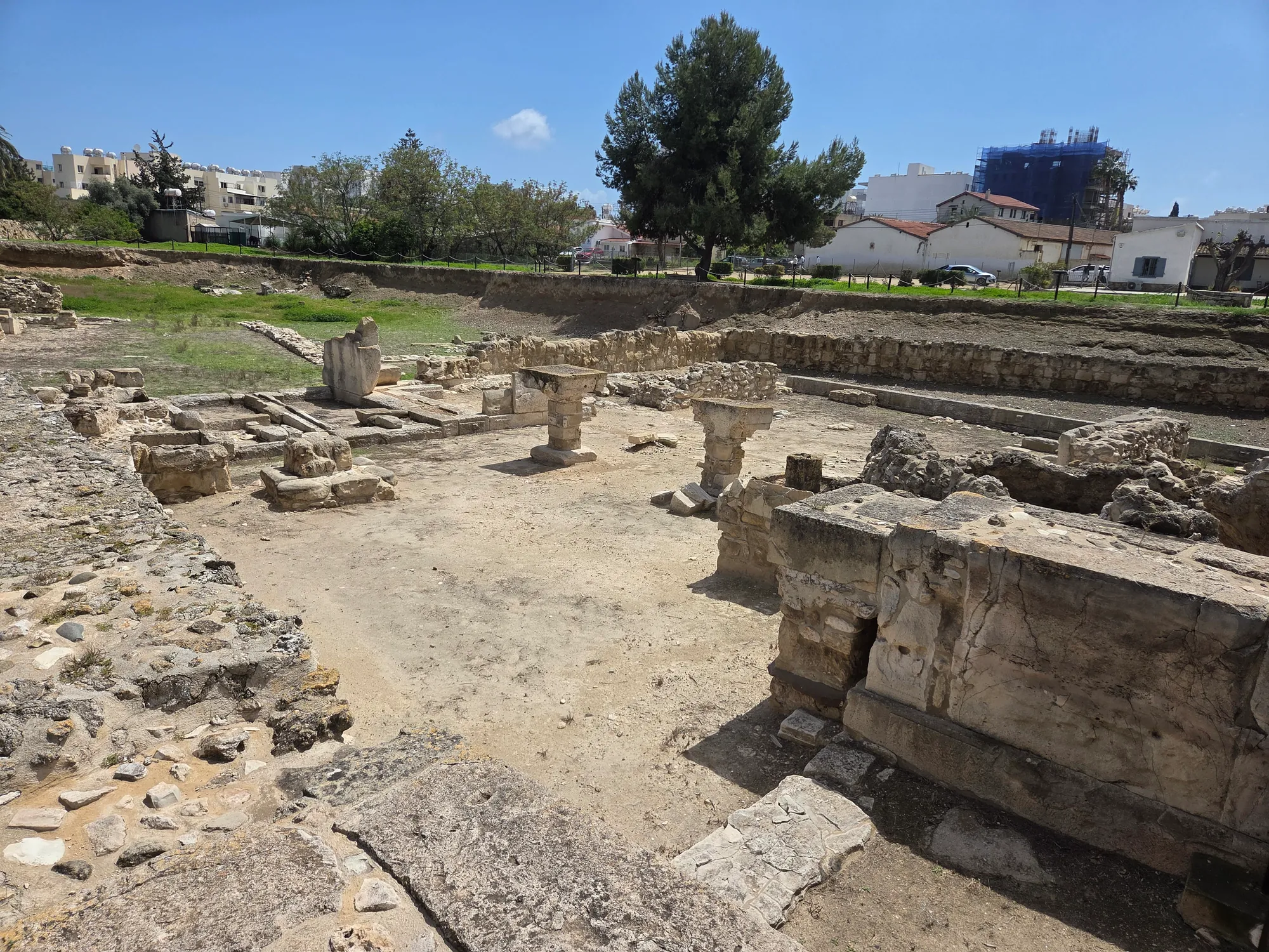
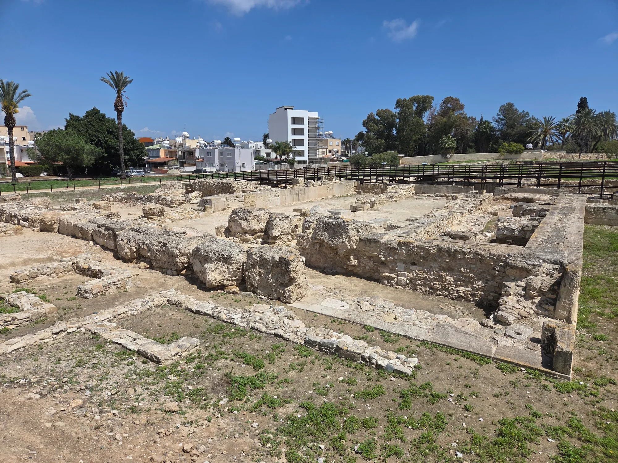
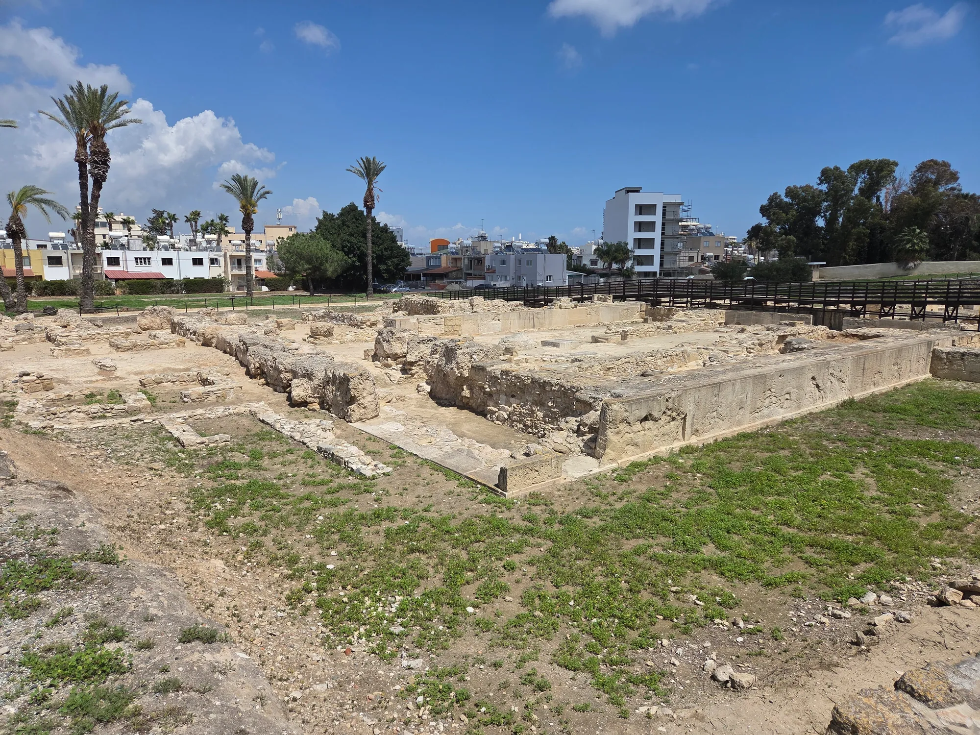
The small Temple 3 was replaced by Temple 1, a rectangular building of about 33.6 m east to west and 22 m north to south. It is a large courtyard with a small recess, 5.30 m deep and 5.25 m wide, on its western side, probably roofed, where the image of the deity was kept. There were three side entrances, one at the north-east corner with a kind of propylaeum, and a corridor 3.30 m wide ran along the south wall [1, pp. 66–67]. The inner face of the courtyard was built of large drafted ashlar blocks of hard limestone, some 3 m long and 1 m high, set on foundations of rough stones; the same kind of masonry was used at Enkomi and at Ras Shamra (Ugarit) in the same period [1, p. 67]. Lead fixings in dowel holes on top of the lower course show that there was at least one more course of ashlar above it [1, p. 71].
North of Temple 1 lay an open court, Temenos A, with an altar for blood sacrifices; Temple 2 was kept, and the space between it and Temple 1 became a second court, Temenos B, so that the quarter now had twin temples and twin sacred courts [1, pp. 65–66, 71]. Two further temples, numbered 4 and 5, stood nearby along the city wall.
Copper workshops beside the temples
West of Temenos A, the ground between Temple 1 and the city wall became an industrial quarter. Its rooms held copper slag and the traces of furnaces; Room 16, next to Temenos A, had three wooden pillars on stone bases and a hearth but no slag, and may have served the temples and the other workshops rather than smelting [1, p. 77]. Karageorghis found it "utterly unexpected" that the workshops should communicate with the sacred area: Room 12 opened straight into the courtyard of Temple 1 through a wide opening at its north-western corner, and Temenos A had two doorways into Room 16 [1, p. 77]. He linked the cult of the temples with the working of copper. The plan is clear; the deity worshipped in the Bronze Age temples is not, since no inscription of that period names it.
Anchors and ship graffiti
Stone anchors are everywhere in the Bronze Age buildings of Kathari. Several dozen were built into the walls, among them the Cyclopean wall, where one measures 1.30 m by 1.07 m by 32 cm; Karageorghis took them for votive anchors from the earlier sanctuaries [1, p. 64]. Some 147 stone anchors have been recorded in the temple complexes, the largest single group from any excavated land site [13, p. 273]. Ships were also scratched on the stone of the temples: nineteen on the southern wall of Temple 1 and others on the altar of Temple 4. L. Basch and M. Artzy published them in the final report [13, p. 147; 14].
From the Bronze Age to the temple of Astarte
The Bronze Age town did not end in a single catastrophe. In Area II, Floor III ran on without a destruction into the next phase, Floor II was rebuilt piecemeal, and a layer of alluvium on Floor II and the deep debris beneath Floor I suggest damage by flood or earthquake rather than by enemies [4]. Floor I was the last; around 1000 BC the sacred quarter was abandoned.
When it was built on again, the builders were Phoenicians. Karageorghis dated their arrival to the middle of the 9th century BC, after "150 years of abandonment", and wrote that they built their temple of Astarte on the foundations of the old Temple 1, which he took to have been a temple of a fertility goddess as well [1, p. 175]. He called it the largest Phoenician temple then known [1, p. 175]. The final report on the Phoenician levels dates the first floor of the Phoenician temple (Floor 3) to about 800 to 725 BC [10, pp. 103–110]. The sanctuary at Bamboula was already built in the 9th century BC [2, pp. 55–66], so how long the city as a whole stood empty is uncertain. The temple was rebuilt several times and stayed in use until the end of the 4th century BC [1, p. 175; 10]. Its bothroi, pits for discarded offerings, held terracotta and limestone statuettes of its last period [1, p. 185].
The cult can be followed through the finds. Ox skulls prepared to be worn as masks lay on the floor of the temple [1, p. 12], and the offerings included figures of the goddess and miniature Black-on-Red juglets. Karageorghis identified the goddess as Astarte from a long Phoenician inscription [1, p. 15].
The kingdom of Kition
Kition was one of the city-kingdoms of Iron Age Cyprus. The stele of Sargon II of 707 BC records the submission of seven Cypriot kings to Assyria and was set up in the city [1, p. 23; 6]. An Assyrian list of 673/2 BC names a Cypriot king of "Qartihadasti", the "new city". Some scholars identify it with Kition, others with Amathus, and the question is open [15; 16, p. 143].
In the 5th and 4th centuries BC Kition was ruled by a Phoenician dynasty whose kings are known from their coins and inscriptions [17]. In the first half of the 5th century the Kitians besieged Idalion, together with the Medes (the Persians), in a war recorded on the bronze tablet of Idalion, and about the middle of the century the kings of Kition annexed the city and took the title "king of Kition and Idalion" [18]. In the 4th century they also acquired Tamassos, and an inscription of 341 BC gives the king the triple title of Kition, Idalion and Tamassos [19, p. 138].
The two last kings are the best documented. Milkyaton reigned from 392/1 to about 362 BC; he came to power in the wars between the Persian king and Evagoras of Salamis, and the trophy base found at Bamboula in 1990 commemorates a victory over his enemies [2, pp. 169–200; 11]. Pumayyaton reigned from about 362 to 312 BC [2, pp. 169–200]. In the wars of Alexander's successors he took the side of Antigonus, and in 312 BC Ptolemy I had him killed and ended the kingdom [1, p. 12].
The city's inscriptions are gathered in Yon's corpus [17]. The most informative is the plaque of temple accounts from the 1879 levelling of Bamboula: written in ink on both faces, seventeen lines on one and twelve on the other, it lists payments to the officials and staff of the temple of Astarte [1, p. 23; 8]. Phoenician remained the language of the city's official writing throughout the life of the kingdom.
Bamboula: sanctuary and war harbour
The French excavations showed that Bamboula was occupied from the early 13th century BC and that its first built sanctuary dates to the beginning of the Cypro-Geometric III period, in the 9th century BC. It was dedicated to Astarte and to Herakles-Melqart, the god whose statues the Swedish expedition had found. In the Classical period the sanctuary was remodelled as an open court between a large building to the south and the harbour to the north, and an Archaic rampart with a square tower closed the area on the south. There was no destruction at the change to the Hellenistic period; in the Roman Imperial period the area declined into a place of wells and cisterns [2, pp. 55–66].
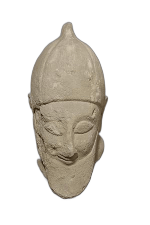 Bearded Votary StatueArchaic II · 600–550 BCBritish Museum
 Limestone Pointed Cap FigureArchaic II · 600–500 BCBritish Museum
 Limestone Male Votary StatueArchaic II · 500–475 BCBritish Museum
 Seated Sphinx FigureArchaic II · 600–400 BCBritish Museum
The ship sheds
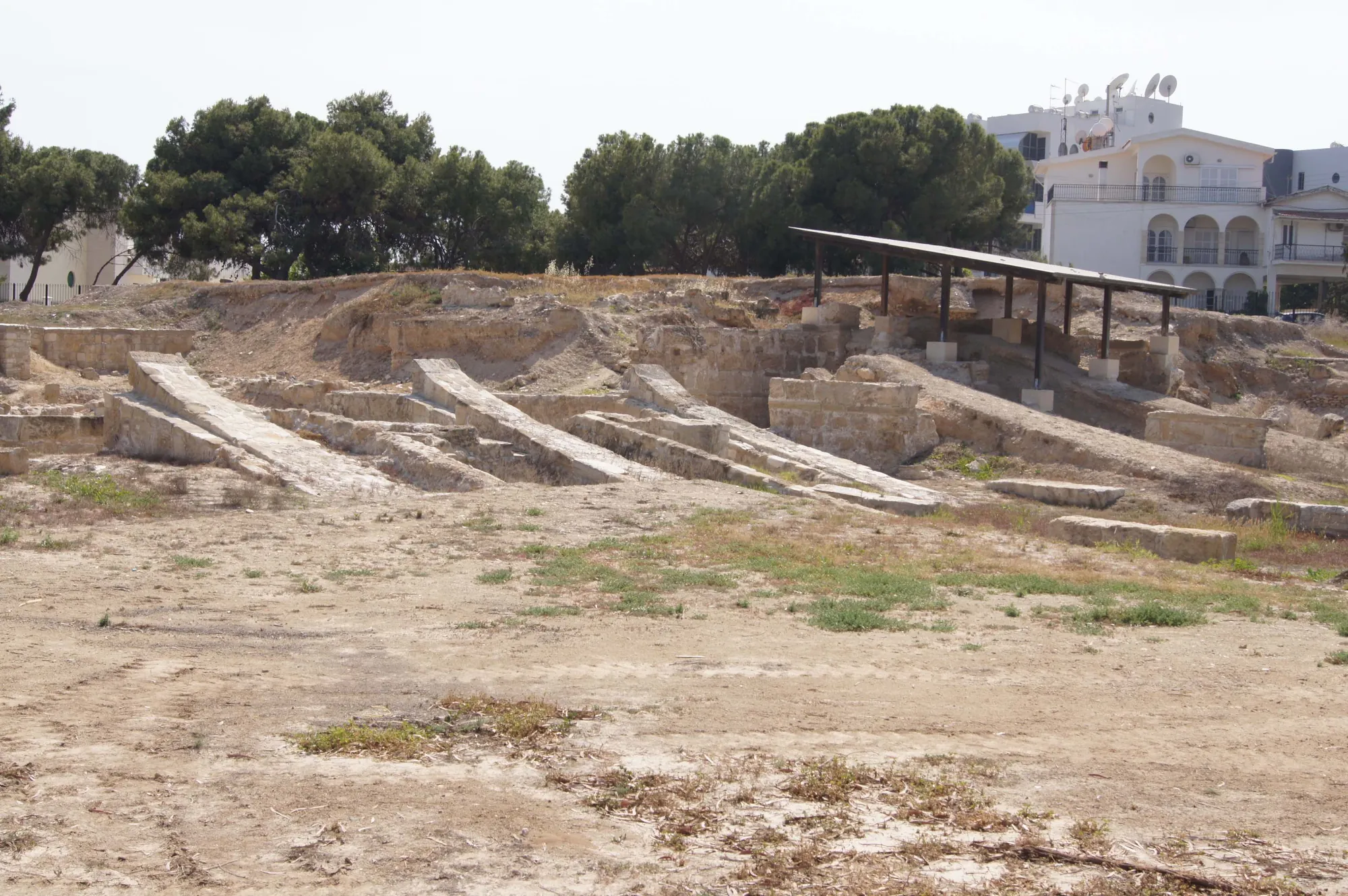
North of the sanctuary lay the war harbour. The French mission uncovered a building of seven parallel ship sheds (neosoikoi), the seventh found in 2021. Each shed is about 5 m wide and about 36 to 37 m long, with a stone slipway 1.70 to 1.90 m wide sloping gently down to the water, and the sheds opened onto a closed harbour basin to the north [2, pp. 69–150]. They are the only ship sheds reliably attested in Cyprus, and their closest parallels are the naval arsenals of Piraeus [2, pp. 301–304].
Plan · 5th to early 3rd century BC
Bamboula: the sanctuary and the ship sheds
Kition-Bamboula, in the town of Larnaca
State II: about the middle of the 4th century BC, the rebuild
1 of 9
The ship sheds
A building of seven parallel bays, each about 37 m long and about 5 m wide, separated by lines of seven pillars that carried the roof. The pillars at the south end of each line are longer than the rest, 3.50 m against about 2.60 m. The building stood below the north end of the sanctuary court and opened north onto the harbour basin. It was first built early in the 4th century BC, probably under King Milkyaton, rebuilt about the middle of the century, and repaired early in the 3rd century, after the end of the kingdom. Pillars drawn in outline are restored.
Callot, Fourrier and Yon 2022, pp. 69 to 150, fig. 8; pp. 169 to 200
Key
- Wall or pillar, excavated
- Wall, robbed or traced on the ground
- Pillar, restored by the excavators
- Wall, line not known
- Altar, well, cistern, tank
- Sounding L-N 13, approximate
- Slipway
- Modern building
- Modern street
- Harbour basin as reconstructed
- Contours at 1 m
The excavators distinguish three states. The first was built in the early 4th century BC on very slight foundations and later collapsed. In the second, about the middle of the century under Milkyaton or early in Pumayyaton's reign, the ground was raised by about 1 m, the walls between the sheds were widened and the roofs were made flat. A third state, in the early 3rd century BC and so after the end of the kingdom, was limited and apparently left unfinished; the excavators place it in the time of Demetrios Poliorketes, who held Cyprus from 306 to 294 BC [2, pp. 169–200]. The sheds were in use for almost the whole of the 4th century and into the first decades of the 3rd [2, pp. 301–304]. The Greek geographer Strabo knew Kition for its "closed harbour".
Zeno of Kition
Zeno, the founder of the Stoic school of philosophy, was born at Kition in the later 4th century BC and died at Athens about 262 BC. Our account of his life comes almost entirely from Diogenes Laertius, who wrote some five centuries later. According to him Zeno came to Athens as a merchant, studied with Crates the Cynic and others, and taught in the Painted Stoa (Stoa Poikile), from which his followers took their name; his teacher called him "the little Phoenician" [3]. The story that a shipwreck first brought him to Athens is one of several anecdotes that need not be taken literally.
Kition after 312 BC
The end of the kingdom did not end the city. Under the Ptolemies the ship sheds at Bamboula were rebuilt in the early 3rd century BC [2, pp. 169–200], and the sanctuary at Bamboula went on receiving offerings into the 3rd century BC [20]. Karageorghis ended the life of the temple of Astarte at Kathari with the kingdom, at the end of the 4th century BC [1, p. 175]; whether it was used for a time afterwards has been debated since the final report appeared.
In the Roman period Kition remained a city, but its buildings are almost unknown because the modern town stands on top of them. At Bamboula the closed harbour basin of the war harbour was filled during the Roman period [2]. The Orthodox metropolis of Larnaca is still called the Metropolis of Kition. The medieval and modern town took the name Larnaca, and the ancient name survived in the church and in scholarship. The topography of the ancient city, as far as it can be traced under the modern one, was gathered by Kyriakos Nicolaou in 1976 [21].
Finds in museums
Kition's finds are divided between several museums. The objects from the Department of Antiquities' excavations, including the faience vessels from the tombs of Area I and the finds from the temples, are in the Cyprus Museum in Nicosia and the Larnaca District Museum. The British Museum holds the finds of 1879 from Bamboula, among them the temple accounts and the limestone sculpture shown above [8]; the Sargon stele is in Berlin [6].
Many objects in older collections are said to come from Kition, above all in the Cesnola collection at the Metropolitan Museum of Art, bought from Luigi Palma di Cesnola, who was American consul at Larnaca. These are the collector's attributions, not documented findspots, and they are not listed here as finds from the site, although some of the inscribed pieces are accepted as Kition texts in Yon's corpus [17].
Pieces in the Drakopoulos collection of kinds found at this site. None of them comes from the site.
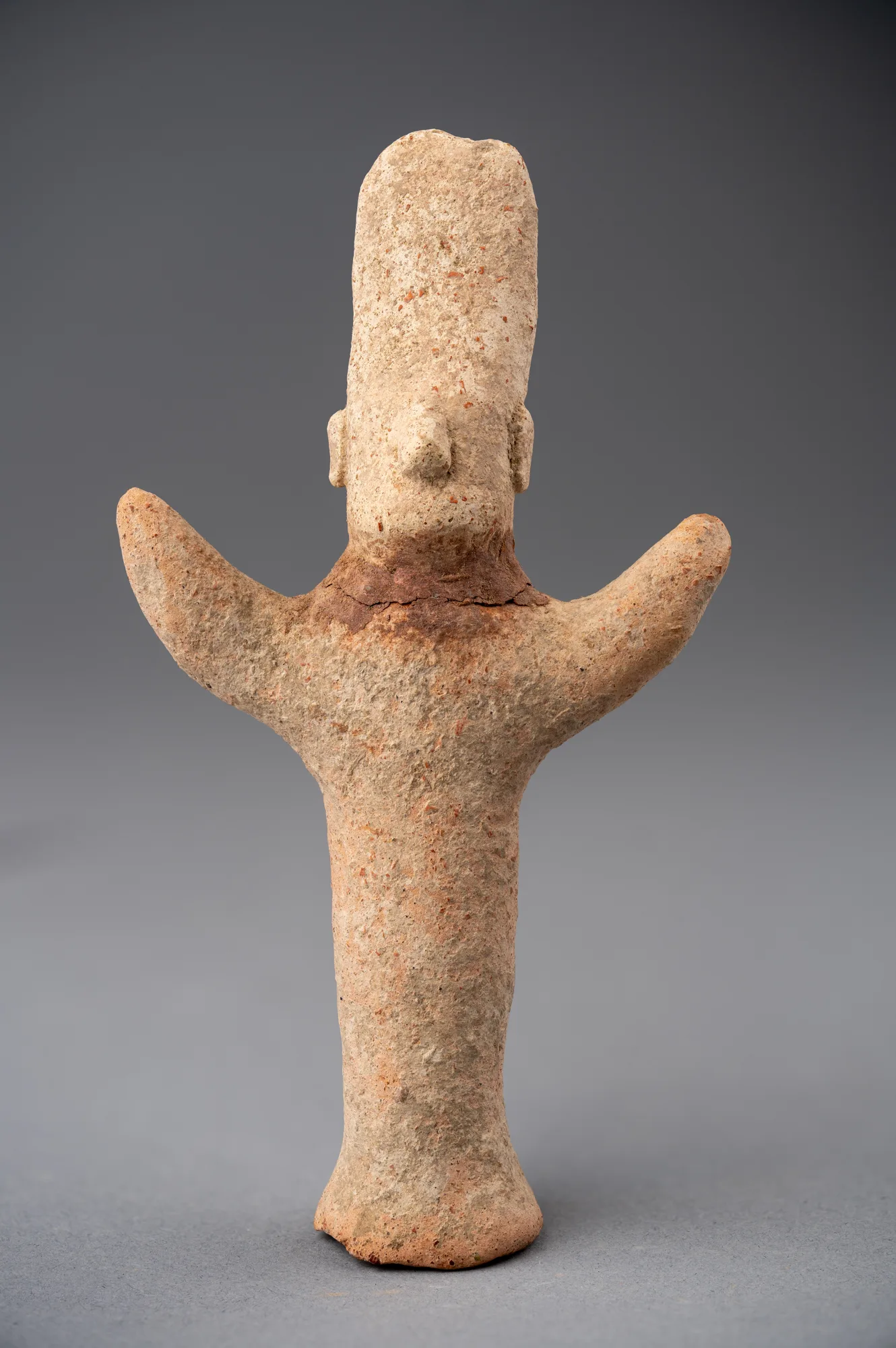 Terracotta Figure with Upraised Arms and Tall Cylindrical HeaddressArchaic · 750–480 BCDrakopoulos collection
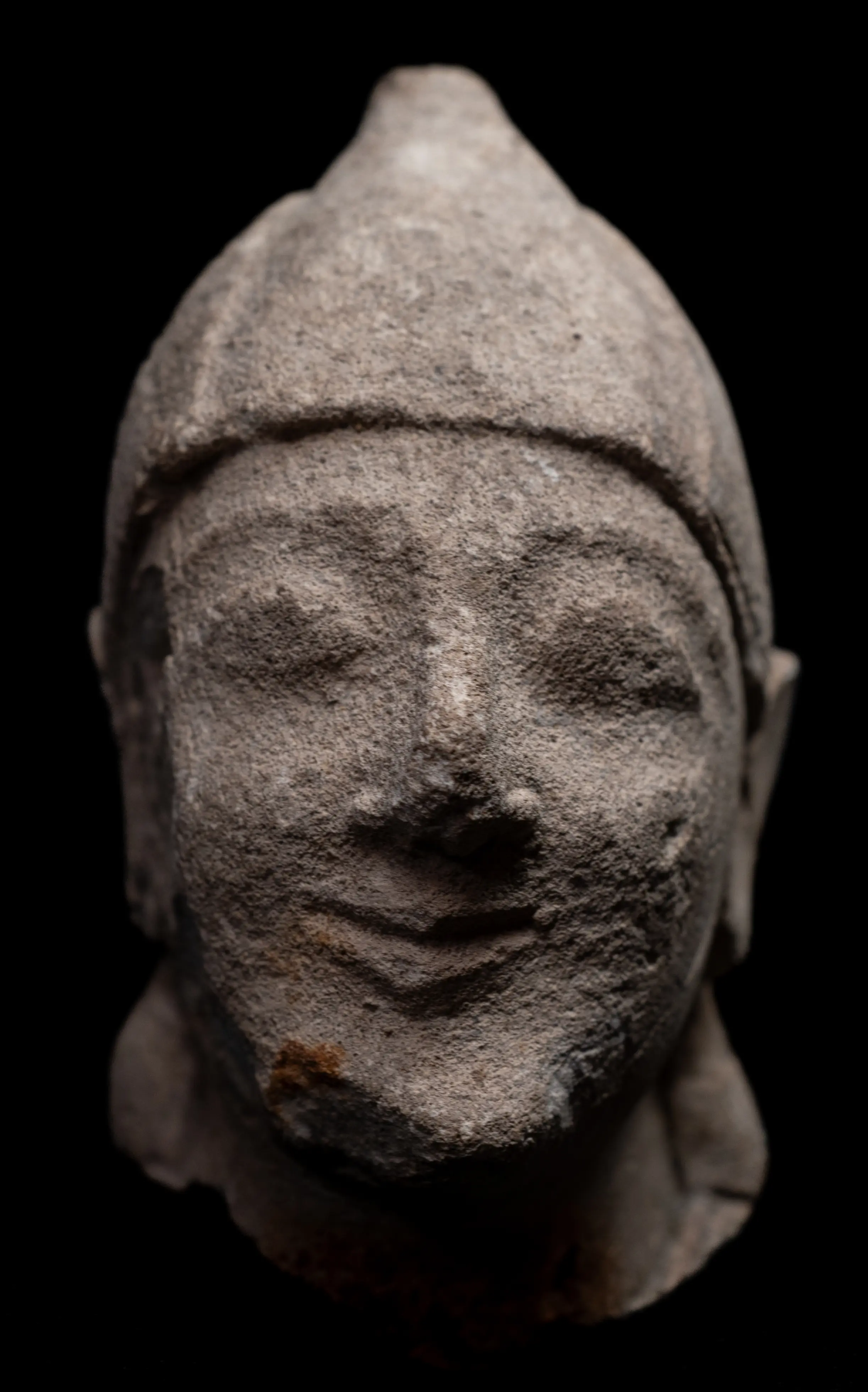 Limestone Head of a Beardless Votary in a Conical HelmetArchaic II · 600–500 BCDrakopoulos collection
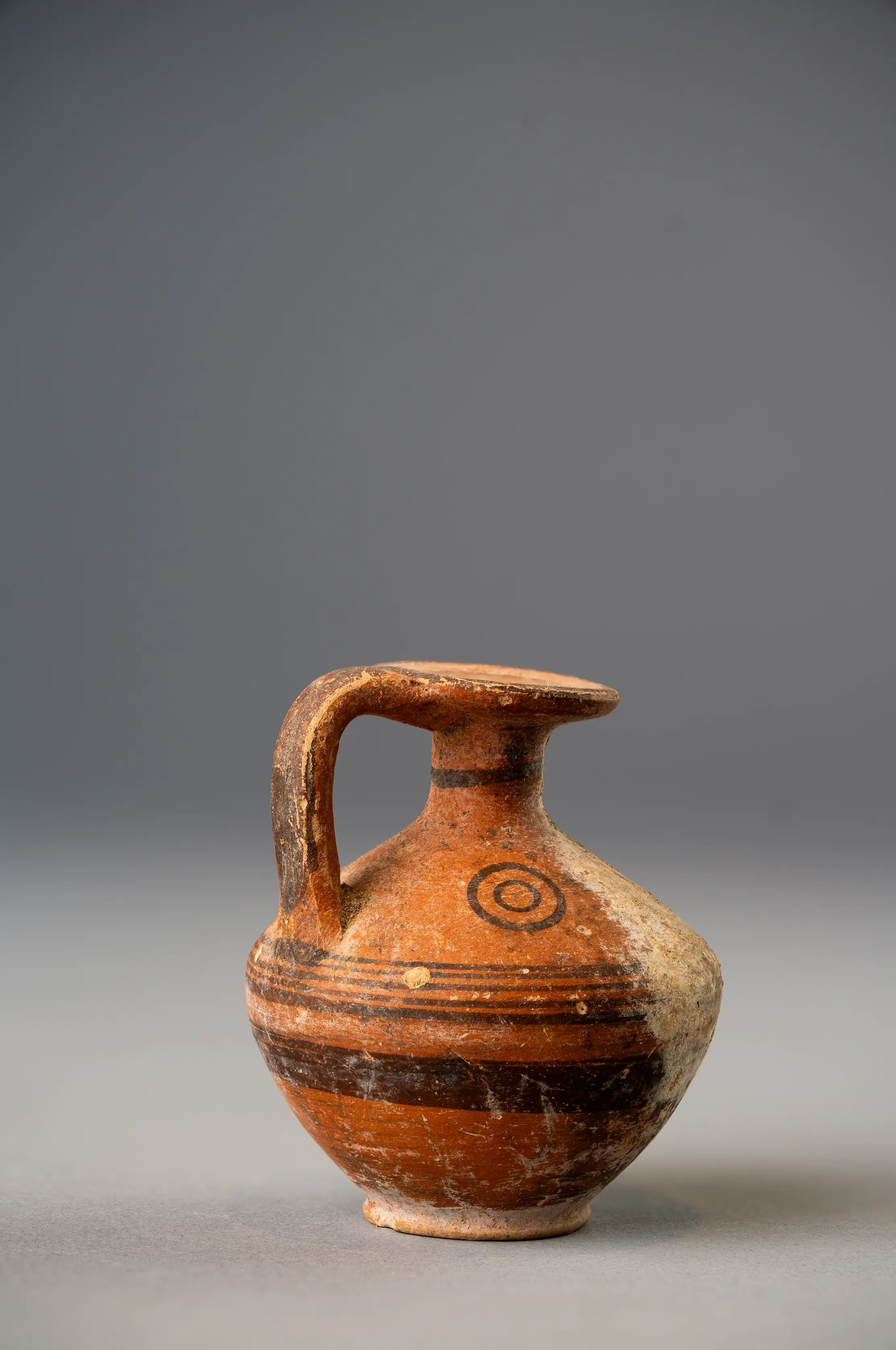 Black-on-Red Biconical Juglet with Disc MouthArchaic II · 700–475 BCDrakopoulos collection
Visiting Kition
The excavated sacred quarter at Kathari (Area II) is open to visitors under the Department of Antiquities. It lies in central Larnaca, behind the Larnaca District Museum, with its entrance from Kilkis Street. Visitors walk along a raised wooden walkway above the remains, which include the low ashlar courses of the temples, the Cyclopean wall and the workshop rooms. Bamboula is a fenced area beside the museum, between Kimonos, Gjerstad and Kilkis Streets [2, pp. 55–66]; the ship sheds can be seen from outside the fence. Opening times and admission change from year to year, so check them with the Department of Antiquities before a visit.
The Larnaca District Museum shows finds from Kition and a cast of the Sargon stele; the Cyprus Museum in Nicosia shows the finest objects from the Department's excavations.
Finds from Kition
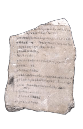 Phoenician Gypsum PlaqueClassical · 400–375 BCBritish Museum
- Seated Sphinx FigureArchaic II · 600–400 BCBritish Museum
- Bearded Votary StatueArchaic II · 600–550 BCBritish Museum
 Limestone Warrior StatueArchaic II · 600–500 BCBritish Museum
- Limestone Pointed Cap FigureArchaic II · 600–500 BCBritish Museum
- Limestone Male Votary StatueArchaic II · 500–475 BCBritish Museum
 Limestone Ram Incense BurnerArchaic II · 500–450 BCBritish Museum
In the Drakopoulos collection
Pieces in the Drakopoulos collection of kinds found at this site. None of them comes from the site.
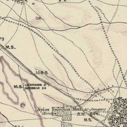
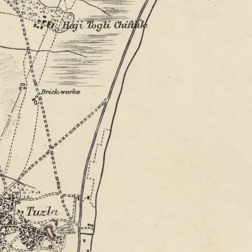
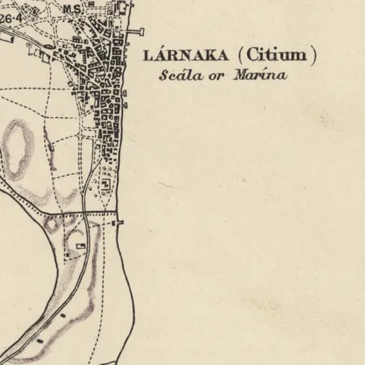
On Kitchener's map (1882)
LÁRNAKA (Citium) · Town
Excavation history
- 1866–1870Luigi Palma di Cesnola's ExcavationsDirected by Luigi Palma di CesnolaClearance and early digging
- 1879–1882Ohnefalsch-Richter's Excavations for the British MuseumDirected by Max Ohnefalsch-RichterClearance and early digging
- 1894Myres for the Cyprus Exploration FundDirected by John Linton MyresExcavation
- 1910–1913Myres at Sotiros and the AcropolisDirected by John Linton MyresExcavation
- 1929–1930Kition-Bamboula: the Swedish Cyprus ExpeditionDirected by Einar Nilson Gjerstad and Alfred WestholmExcavation
- 1953–1981Department of Antiquities Rescue Work in the Town and CemeteriesRescue excavation
- 1959–1983The Department of Antiquities Excavations at Kathari and ChrysopolitissaDirected by Vassos KarageorghisExcavation
- 1975South-East Coast: the University of Minnesota Environmental SurveyDirected by George Rapp and John GiffordSurvey
Show all 13 projects
- 1976–todayKition-Bamboula: the French MissionDirected by Marguerite Yon and Sabine FourrierExcavation
- 1979Kition-Ayios Georgios: Rescue Excavation of the Ancient NecropolisDirected by Sophocles HadjisavvasRescue excavation
- 1988–2005Kition-Ayios Georgios: Department rescue excavations in the cemetery (1988–2005)Rescue excavation
- 2012–2018Larnaca: Department rescue excavations along the sewerage network (2012–2018)Rescue excavation
- 2019–2021Larnaca, Petrakis Kyprianou Street: Department rescue excavation in the S9 anti-flood worksDirected by Polina ChristofiRescue excavation
In the Archive
592 photographs (348 of objects, 235 in the field, 8 other, 1 other), 8 plans, 3 paintings, 2 letters and 1 document. A selection is shown here.
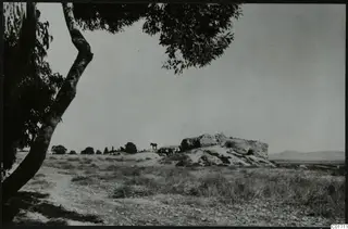 C01711Kition, Bamboula from the south
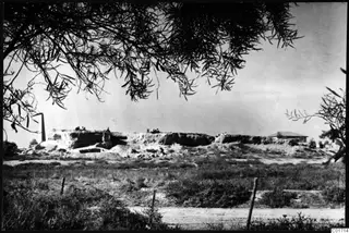 C01714Bamboula from the east, Kition
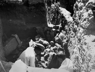 C01717Kristos and Alfred Westholm excavating at Kition
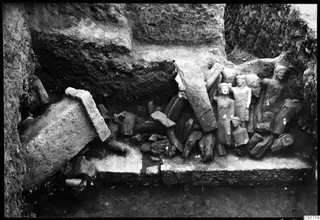 C01719Kition cult room, statues in situ
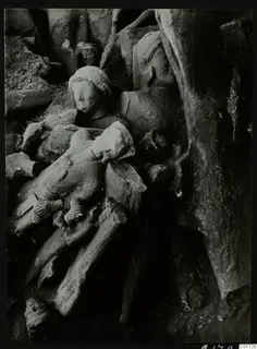 C01726The cult room at Kition, the big deposit: detail of sculptures, bodies and heads
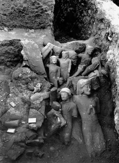 C01728Cult room, large deposit at Kition, detail with larger sculptures
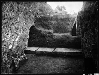 C01746The large profile wall inside the cult room at Kition
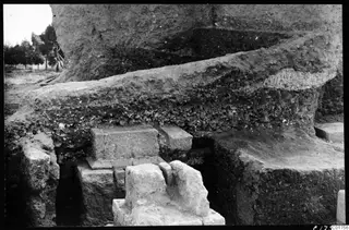 C01756Soil section by pedestal 2 at Kition
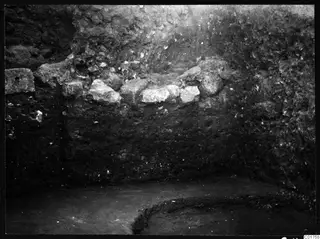 C01758Soil profile in the eastern part of the Bamboula, Kition
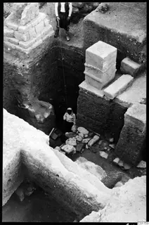 C01759East of the cult room I-III at Kition, deep digging with architectural elements
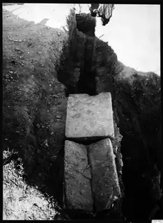 C01762Roman water channel, plan at Kition
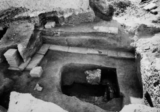 C01766The cult room at Kition, excavated from the north
Photographs: Swedish Cyprus Expedition, Medelhavsmuseet, Stockholm (CC0)
Nearby sites
- Larnaca-American Academy0.0 km
- Larnaca-Hospital0.0 km
- Larnaca-Stadium0.0 km
- Larnaca-Ayios Prodromos0.8 km
- Larnaca-Cobham's Tomb0.8 km
- Larnaca-Evangelis Tomb0.8 km
Straight-line distances.
Mentioned in
351 mentionsDocuments · 169
- Field diary D II:2 E: Ajios Fokas 1929; Ajios Akoufos; Kition; Amathus
1929 · pp. 47, 94
site excavated from 1 Oct 1929 at Bamboula
Alfred Westholm, 1929, Field diary D II:2 E: Ajios Fokas 1929; Kition & Amathus, p. 47
- The limestone sculpture from Kition
1980 · p. 49
Conical caps are more common on votive figures from Kition, whose close ties were with the Levant.
P. Gaber, 1980
- Cyprus and the East Mediterranean in the Iron Age: Proceedings of the Seventh British Museum Classical Colloquium, April 1988
1989 · pp. 28, 32
Phoenician city whose terracotta workshops are described
Tatton-Brown 1988, p. 28
- Les hangars du port chypro-phénicien de Kition. Campagnes 1996-1998 (Mission française de kition-Bamboula)
2000 · pp. 95, 102
city whose harbour and ship-sheds are excavated
Yon 1998, p. 95
- Review
2001 · p. 374
site of the excavations reported in Kition V
Hermary 2001, p. 374
- The worship of Anat and Astarte in Cypriot Iron Age sanctuaries
2005 · pp. 200, 203, 204
Phoenician city-kingdom with Astarte inscriptions and sanctuaries
Ulbrich 2005, p. 200
Lectures and videos · 70
- 2nd Annual ARU Study Day: Cypriot Bronzes, Copper at Kition, the Vouni Hoard, and Maritime Outreach
2017 · 0:30:00
Sanctuary abandoned end of 11th century and rebuilt late 9th century as sanctuary of Astarte; Floor 3 phase dated 800-725 BC with metallurgical activity
Papasavvas et al. 2017
- Alassa 17 years later: A retrospective
2017
Hadjisavvas 2017
- Hidden in the Shadow of the Stamps: Discovering the Variety and the Economic Importance of Hellenistic Transport Amphorae in Nea Paphos
2017
Dobosz 2017
- Innovative Educational Programmes in Museums: The Ministry of Education and the Leventis Municipal Museum
2017 · 0:14:04
Museum programme 'Θάλασσα θάλασσα' at the Larnaca District Archaeological Museum concerns the role of the sea for the ancient inhabitants of Kition
Lambrianou & Lymperopoulou 2017
- New Swedish Cyprus Expedition excavations at Hala Sultan Tekke, 2010–2017
2017
Fischer & Bürge 2017
- Study Day on Book 23 of the Iliad: Cremation Burials and Homeric Heirlooms in Cyprus
2017
Karageorghis et al. 2017
Tomb records · 13
- Kition, Karageorghis Tomb 1
1959
Karageorghis 1960
- Kition, Karageorghis Tomb 10
1959
chypro-géométrique I-II
Smith 2009
- Kition, Karageorghis Tomb 11
1959
chypro-géométrique I-II
Karageorghis 1960
- Kition, Karageorghis Tomb 2
1959
Early Bronze Age III 2000-1850 BC
Smith 2009
- Kition, Karageorghis Tomb 3
1959
Buchholz & Karageorghis 1971
- Kition, Karageorghis Tomb 4
1959
Chamber tomb, Late Cypriot (Late Bronze Age)
Karageorghis 1976
People · 1
- Timothy Turner
Received objects from here · 1791
Mariti, Giovanni, 1736-1806; Robinet, J. B. (Jean Baptiste), 1735-1820, supposed tr; Castillon 1799
Institutions · 14
- Deutsches Archäologisches Institut, Abteilung Athen
Probably · Photographs of it · 1890
Female head with sistrum top (capital?) - Larnaca - Stone - Architectural parts
Deutsches Archäologisches Institut, Fotothek 1890
- Cyprus Broadcasting Corporation
Films of it · 1965
ΚΥΠΡΟΣ ΕΝΑ ΤΑΞΙΔΙ - ΑΡΧΑΙΟ ΚΙΤΙΟΝ
Cyprus Broadcasting Corporation, film, 2006; Cyprus Broadcasting Corporation, film, 1971; Cyprus Broadcasting Corporation, film, 1965
- Antikensammlung, Staatliche Museen zu Berlin
Objects from it in the collection
21 object records giving it as the find-place
Antikensammlung, Staatliche Museen zu Berlin, collection online
- Ashmolean Museum of Art and Archaeology
Objects from it in the collection
58 object records giving it as the find-place
Ashmolean Museum of Art and Archaeology, collection online
- British Museum
Objects from it in the collection
57 object records giving it as the find-place
British Museum, collection online
- Fitzwilliam Museum
Objects from it in the collection
2 object records giving it as the find-place
Fitzwilliam Museum, collection online
Also in National Museum in Kraków, collection online; Smithsonian Institution, collection online
Press releases 1962–74 · 50
- Excavations at Kition (1962-10-25)
1962
Dr. V. Karageorghis, Curator of the Cyprus Museum, directed excavations for the Department of Antiquities at a plot owned by Mr. Th. Phrangescides near…
Press and Information Office, Republic of Cyprus, press release of 1962-10-25
- Ανασκαφαί εις Κίτιον (1962-10-25)
1962
The Department of Antiquities completed this year's excavation season at Kition near Larnaca, under Dr Vassos Karageorghis, with results described as beyond…
Press and Information Office, Republic of Cyprus, press release of 1962-10-25
- Excavations at ancient Kition (1963-08-03)
1963
Tombs of the Early and Middle Bronze Ages were discovered at Kition, used as a necropolis.
Press and Information Office, Republic of Cyprus, press release of 1963-08-03
- New light on the history of Kition (1963-11-23)
1963
The Department of Antiquities completed the autumn season of excavations at the Late Bronze Age site of Kition under Dr. V. Karageorghis, assisted by Mrs. A…
Press and Information Office, Republic of Cyprus, press release of 1963-11-23
- Ανασκαφαί εις το Αρχαίον Κίτιον (1963-08-03)
1963
The Department of Antiquities excavated at the Chrysopolitissa church site in Larnaca (Mycenaean Kition) from April to June, directed by Dr V. Karageorghis…
Press and Information Office, Republic of Cyprus, press release of 1963-08-03
- Ανασκαφαί εις το Αρχαίον Κίτιον (1963-08-03)
1963
The Department of Antiquities carried out archaeological excavations at Kition near Larnaca from April to June 1963, under Dr V. Karageorghis, Ephor of the…
Press and Information Office, Republic of Cyprus, press release of 1963-08-03
News · 22
- 22 girls in a Phoenician account tablet from Kition took part in a substitution rite, study argues
2026
- Aphrodite at the Ashmolean: Cyprus lends a sanctuary figurine of a woman giving birth
2026
- Athens' 200 triremes were built partly with timber from Cyprus, study says
2026
- Bull and ibex gold diadems from Hala Sultan Tekke tombs were probably made on Cyprus, study argues
2026
- Charred barley and chaff in a Pyla shaft point to stored animal fodder around 1200 BCE
2026
- Cyprus and France sign a culture declaration that names archaeological research and heritage
2026
- Excavations · 12listed under Excavation history
- Archivelisted under In the Archive
References
- 1.Karageorghis, V. (1976). Kition: Mycenaean and Phoenician discoveries in Cyprus. Thames and Hudson.
- 2.Callot, O., Fourrier, S., & Yon, M. (Eds.). (2022). Kition-Bamboula VIII. Le port de guerre de Kition. MOM Éditions. https://doi.org/10.4000/books.momeditions.13617
- 3.Diogenes Laertius. Lives of the Eminent Philosophers, book 7 (Zeno).
- 4.Karageorghis, V., & Demas, M. (1985). Excavations at Kition V: The Pre-Phoenician Levels, Areas I and II. Department of Antiquities, Cyprus.
- 5.Göransson, K. (2012). The Swedish Cyprus Expedition: The Cyprus collections in Stockholm and the Swedish excavations after the SCE. Cahiers du Centre d'Études Chypriotes, 42, 399–421. https://doi.org/10.3406/cchyp.2012.1033
- 6.Radner, K. (2010). The Stele of Sargon II of Assyria at Kition: A Focus for an Emerging Cypriot Identity? In Interkulturalität in der Alten Welt: Vorderasien, Hellas, Ägypten und die vielfältigen Ebenen des Kontakts, 429–449.
- 7.Merrillees, R. S. (2016). Studies on the provenances of the stele of Sargon II from Larnaca (Kition) and the two so-called Dhali (Idalion) silver bowls in the Louvre. Cahiers du Centre d'Études Chypriotes, 46, 349–386. https://doi.org/10.3406/cchyp.2016.1698
- 8.Kiely, T., & Fourrier, S. (2012). Excavations at Kition-Bamboula 1879. Finds in the British Museum. Cahiers du Centre d'Études Chypriotes, 42, 273–304. https://doi.org/10.3406/cchyp.2012.1027
- 9.Gjerstad, E., Lindros, J., Sjöqvist, E., & Westholm, A. (1937). The Swedish Cyprus Expedition: Finds and Results of the Excavations in Cyprus 1927-1931, Vol. III. The Swedish Cyprus Expedition.
- 10.Karageorghis, V., with Callot, O. (2005). *Excavations at Kition VI: The Phoenician and Later Levels. Part I*. Department of Antiquities, Cyprus.
- 11.Yon, M., & Sznycer, M. (1991). Une inscription phénicienne royale de Kition (Chypre). Comptes rendus de l'Académie des Inscriptions et Belles-Lettres, 791–823.
- 12.Knapp, A. B. (2012). Matter of fact: Transcultural contacts in the Late Bronze Age eastern Mediterranean. In J. Maran & P. W. Stockhammer (Eds.), Materiality and social practice: Transformative capacities of intercultural encounters, 32–50. Oxbow Books.
- 13.Wachsmann, S. (2009). Seagoing Ships and Seamanship in the Bronze Age Levant. Texas A&M University Press.
- 14.Basch, L., & Artzy, M. (1985). Ship Graffiti at Kition. In V. Karageorghis & M. Demas, *Excavations at Kition V. The Pre-Phoenician Levels, Areas I and II, Part I*, 322–336. Department of Antiquities, Cyprus.
- 15.Yon, M., & Childs, W. A. P. (1997). Kition in the Tenth to Fourth Centuries B.C. Bulletin of the American Schools of Oriental Research, 308, 9–17.
- 16.Iacovou, M. (2013). The Cypriot syllabary as a royal signature: The political context of the syllabic script in the Iron Age. In P. M. Steele (Ed.), Syllabic Writing on Cyprus and its Context, 133–152. Cambridge University Press.
- 17.Yon, M. (2004). *Kition dans les textes: Testimonia littéraires et épigraphiques et corpus des inscriptions (Kition-Bamboula V)*. Éditions Recherche sur les Civilisations.
- 18.Hadjicosti, M. (1997). The Kingdom of Idalion in the Light of New Evidence. Bulletin of the American Schools of Oriental Research, 308, 49–63.
- 19.Papantoniou, G. (2012). Religion and Social Transformations in Cyprus: From the Cypriot Basileis to the Hellenistic Strategos. Brill.
- 20.Caubet, A., Fourrier, S., & Yon, M. (2015). Kition-Bamboula VI. Le sanctuaire sous la colline. Maison de l'Orient et de la Méditerranée.
- 21.Nicolaou, K. (1976). The Historical Topography of Kition. Paul Åströms Förlag.
Corrections and additions
Do you know this site?
Help us keep this page right: recent work, the site as it is now, and what we may have missed.
Missing from this record
- Location approximate
We would like to hear about
- Recent fieldwork or publications
- A wrong location or name
- Access, opening times or the site's state today
- Photographs we may use
Tell us if you would like to be thanked by name on the page.