
Contents
The Late Bronze Age of Cyprus, the Late Cypriot period of about 1650 to 1050 BCE, is usually told through its towns: the ashlar buildings, copper workshops and imported Aegean and Levantine pottery of the coast. The countryside behind them is far less known. This entry turns to the farming settlements, mining hamlets and pottery sites that fed the towns and supplied their copper, using the handful of rural sites that have actually been excavated. It continues the story told in village life in Early Bronze Age Cyprus and village life in Middle Bronze Age Cyprus. What people ate, and how the towns stored oil on a vast scale, is treated under food and diet; the copper industry itself under copper metallurgy.
A composite, not a type
The first thing to say about the Late Cypriot village is that there is no single excavated example of one. Louise Steel observes that the social and material world "of the average Late Bronze Age Cypriot" has "received less attention" than the strategies of the elites, and that debate has centred on sociopolitical models of how the island was run [1, p. 512]. Apart from survey at Analiondas-Palioklichia and a supposed sanctuary at Ayia Irini, the inland farming communities "have been largely unstudied", although they "form the linchpin" of the settlement hierarchies that those models describe [1, p. 512].
The village described here is therefore assembled from pieces. The farming settlement at Aredhiou-Vouppes, excavated by Steel, supplies the buildings and the daily routine. The copper-mining settlement at Apliki-Karamallos and the smelting site at Politiko-Phorades supply the industrial side. A grain-storage site at Analiondas, known from survey, supplies the staples, and a pottery-making site at Sanidha shows rural craft production. Each site is a different kind of place, in a different part of the island, at a slightly different date. None of them is typical; together they show the range.
Numbers need the same caution. Maria Iacovou warned that the size charts for Late Cypriot settlements "have become dangerously misleading": the estimates are "not based on common, clearly defined criteria", they ignore "the high diversity factor among settlements", and the sites have been explored very unevenly [2, p. 1]. Her particular target was the ranking of towns "that ranged from 12–70 ha or more" [2, p. 1]. The same problem affects the villages, as the two quite different size figures for Aredhiou show below.
Where the village sat: the settlement hierarchy
Archaeologists have long described Late Cypriot settlement as a hierarchy, and the village has its place in each version. Hector Catling proposed three tiers: coastal urban centres, inland agricultural settlements such as Aredhiou, and copper-production centres [1, p. 512]. Priscilla Keswani saw these settlements coexisting "within a nexus of regional exchanges of wealth and staple finance, the interior effectively providing foodstuffs and other resources to support the coastal towns" [1, p. 512]. Bernard Knapp refined the scheme into four tiers, summarised by Steel [1, p. 512]:
| Tier | Kind of settlement | Examples named |
|---|---|---|
| 1 | Large urban centres on the coastal plains | Enkomi, Hala Sultan Tekke, Kalavasos-Ayios Dhimitrios, Episkopi-Bamboula |
| 2 | Inland towns with administrative, production, transport and storage functions | Pyla-Kokkinokremos |
| 3 | Smaller inland sites, mainly religious, with some production and storage | Myrtou-Pigadhes, Athienou |
| 4 | Specialised production sites | Agricultural: Aredhiou. Mining: Apliki, Politiko-Phorades. Industrial: Sanidha |
The first tier includes Enkomi and Episkopi-Bamboula; Athienou sits in the third. In this scheme Kalavasos-Ayios Dhimitrios counts as a primary centre, which is why this entry does not treat it as a village. Vasiliki Kassianidou sums up the pattern from the copper side: urban centres were established along the coast, while "important settlements located inland possessed monumental architecture and large storage facilities for olive oil" [3, p. 347].
Steel's excavation at Aredhiou tested the bottom tier of this model and found it wanting. The sites posited as agricultural turned out to be "far more complex than the current typology, which for the most part is based on survey data, would suggest": they were multifunctional places, not single-purpose farms [1, p. 513]. The tiers remain useful as a map of the kinds of place that existed. They are less reliable as a description of any one site.
Dates are given here in Steel's scheme: Middle Cypriot III 1750–1650 BCE; Late Cypriot IA 1650–1550; LC IB 1550–1400; LC IIA–B 1400–1340/1315; LC IIC 1340/1315–1200; LC IIIA 1200–1100; LC IIIB 1100–1050 [1, p. 512]. Most of the rural evidence belongs to LC IIC, the thirteenth century BCE.
A farming village excavated: Aredhiou-Vouppes
Aredhiou-Vouppes was found in 1993 by the Sydney Cyprus Survey Project. Its local name, Lithosouros, means "mound of stones", and it lies at the interface of the Mesaoria plain and the Troodos foothills [1, p. 514]. Knapp describes it as sitting on the Aloupis river drainage "where the agricultural plain meets the igneous (metal-bearing) foothills", with pottery, pithoi, a wall-bracket fragment and ground stone scattered over about 2 ha [4, p. 572]. Steel's figure is larger: material spreads over an area "possibly as large as 10 ha", but as "dispersed scatters of activity, rather than a large planned complex", and modern terracing has removed the deposits down to bedrock in places [1, p. 515]. The difference lies partly in what is counted, a core of survey finds or the wider dispersed scatter, and neither figure is a population estimate.
The survey material already pointed to farming. Pithoi predominate, mostly smaller short-necked jars for the short-term storage of food, and there were many ground stone tools: rubbers, grinders, polishers, hammerstones and querns. Local farmers reported removing "cartloads of worked stones" from their fields over fifty years [1, pp. 515–516].
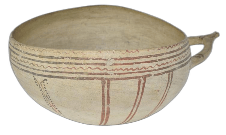
The site had two phases. The early one, in MC III and LC I (c. 1750/1700–1400 BCE), was "a small, self-sufficient community", perhaps "only a handful of households", which nonetheless had access to the new wares of the period: Monochrome, Base Ring I, White Slip I and some Red-on-Black. A disturbed tomb of this phase held a Black Slip Wheelmade jug and a hook-tanged bronze spearhead [1, pp. 517–519]. A handmade White Slip I bowl of the period, with a wishbone handle and painted wavy lines, is in the British Museum: White Slip wish-bone bowl.
The main phase is LC IIC, the thirteenth century BCE, and there is no clear continuation into LC IIIA [1, p. 517]. In this phase the site was "subdivided into discrete activity zones" around two main buildings that shared an alignment. No ordinary houses have been found, probably because terracing destroyed them, but Tomb 1 on the eastern edge of the site suggests where people lived and buried their dead [1, p. 519]. Steel's reading is that activities were "housed within communal buildings rather than within separate households". The finds cover farming, storage, food processing, some herding, textile production and eating and drinking, and they include imports from Egypt, the Aegean and the Levant [1, p. 520].
The buildings were put up with care. Walls used diabase river pebbles, thresholds were made of stone brought in from elsewhere, and Building 2 was laid out entirely in right angles, with a foundation deposit [1, p. 520]. Steel interprets Building 2 as a barn or warehouse for grain or straw. It had wide entrances for pack animals or carts and few pithoi, which suggests primary storage straight from the fields; the contents may have been fodder for donkeys and oxen, or rations for miners [1, p. 522]. In a small room of Building 2 was a well, stone-lined for its upper metre, in a space large enough for one person and with restricted access. It contained only fourteen sherds and a large quern. It had not been used for rubbish, unlike the wells in the towns, and it differs from the communal wells known at Hala Sultan Tekke and Episkopi-Bamboula [1, pp. 521–522].
Building 1 was L-shaped, with external walls 0.5 m thick, and Steel describes it as "nondomestic, some form of public or communal building". Its finds include an upturned, worn quern, copper slag, a very large pounder like those from Apliki, plain bowls, White Slip bowls, a cooking pot and a basin stand for processing liquids. Work surfaces were made of pebbles and slag, with anvil stones set into them [1, pp. 522–524].
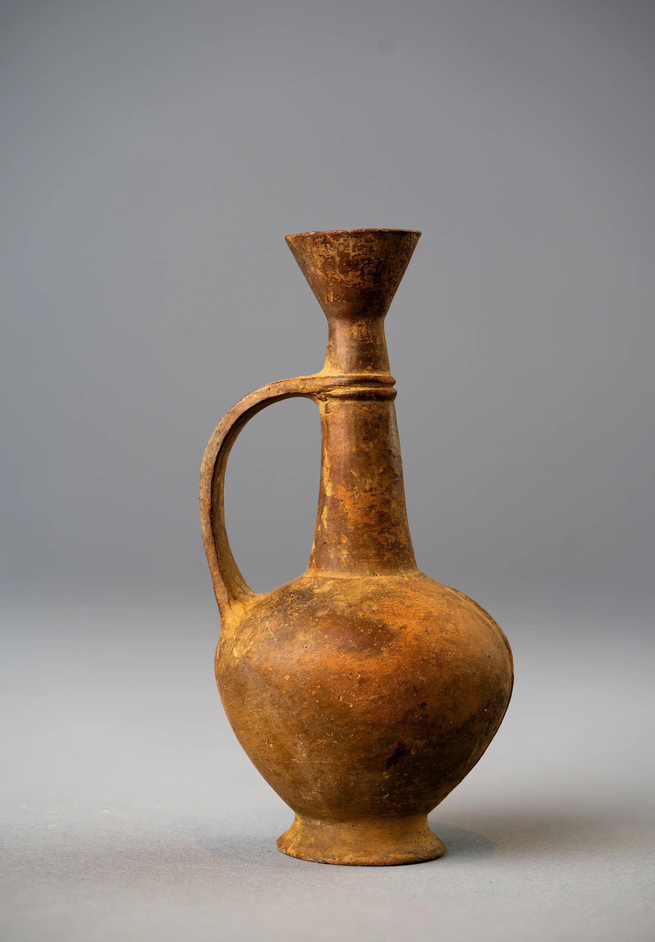
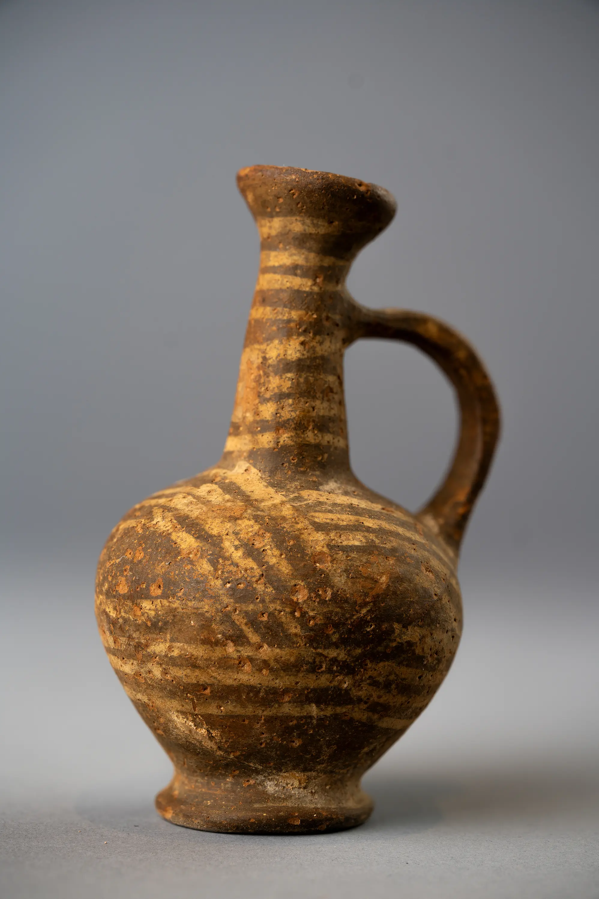
One room shows that the community had its own ceremonies. Room 103 was sunken and held a lamp, wall brackets, a krater, Base Ring bull vessels used for libations and a Red Lustrous flask; Steel reads these as the equipment of ceremonies for "a select and restricted group" [1, p. 527]. Drinking sets combined Mycenaean shallow bowls and local White Painted Wheelmade III imitations of them with Base Ring carinated cups and White Slip hemispherical bowls, a set that "conforms to the LC IIC norm elsewhere on the island" [1, p. 527]. A White Slip II hemispherical bowl from Idalion in the British Museum, 1978,0717.3, with a wishbone handle and ladder and hooked-chain friezes, is the kind of bowl in question. The Base Ring jugs in the Drakopoulos collection, such as the jug illustrated at the head of this entry and the second jug shown here, belong to the same handmade table ware; neither has a known find-spot. What the White Slip bowls actually held, and the history of the "milk bowl" label, is discussed under food and diet.
Seasons of work: farming, mining and who went where
Aredhiou had no metalworking installation, yet about 10 kg of copper slag was built into Building 1, and the site kept tools of the kind used at Apliki. Steel suggests that the men of the village may have worked in the mines in summer and returned to farm from autumn to spring [1, p. 519]. The idea finds support at the other end of the process. At Politiko-Phorades, a smelting site in the foothills, Knapp found numerous tiny snail shells inside the slag bank, which "may be taken as one indicator that these industrial operations were conducted seasonally", during "down time in the agricultural calendar" [4, p. 563]. The ore probably came from the gossan at Kokkinorotsos, about 800 m to the northwest. Phorades had "almost nothing indicative of a living community", and the people who worked it must have lived in a community "almost certainly ... situated on the arable land nearby" [4, p. 563].
If the men left for the mines, the household tasks would have fallen to women, and women and children would also have worked in the fields, above all at harvest [1, p. 528]. Steel warns against essentialist analogies here, but she points to tasks that the evidence associates with women: carrying water, grinding and textile work. LC II and III anthropomorphic bottles show women carrying water jars on their heads, and a loomweight and a small stone weight were found beside Building 2 among domestic debris and animal bone [1, pp. 527–529]. The tools of spinning and weaving are covered under spindle whorls and textile tools.
Aredhiou also produced an "unusually high incidence of gaming stones", including a senet board in the rubble south of Building 2. Steel allows that some may have been counting or calendrical devices; her comparison with men playing games in a modern village kafeneion is offered, in her own words, as speculation [1, pp. 529–530]. The Museum of Cycladic Art holds a limestone gaming stone with three rows of ten cavities, a layout the museum identifies with Egyptian senet: Ζ0354bis. It is dated 2000–1800 BCE, several centuries before Aredhiou, and shows the type of board rather than a contemporary one.
Some objects were put away deliberately. An 88 kg quern was placed in the well, and gaming stones were built into walls [1, p. 530]. Steel treats both as structured deposition.
The mining village: Apliki-Karamallos
The ore bodies of the Solea valley (Mavrovouni, Skouriotissa and Apliki) are the richest on Cyprus, and lead-isotope analysis links Apliki with most oxhide ingots found in Cyprus and abroad [3, p. 346]. Kassianidou states it more precisely in her conclusion: the copper of all the oxhide ingots dated after 1450 BCE is consistent with the Apliki deposit [3, p. 354]. The Cyprus Mines Corporation began exploiting Apliki in 1938, and Joan du Plat Taylor excavated the settlement as a rescue project. The open-cast mine destroyed the site in the 1960s, and the excavation was published by Kling and Muhly in 2007 [3, p. 347].
In Trench A stood an L-shaped building with rooms around a courtyard, destroyed by fire; the houses in Trench B were abandoned but not burnt. Radiocarbon dates place the construction just after 1300 BCE and the destruction between 1200 and 1180 BCE, in LC IIC [3, p. 348]. The rooms were "full of large storage vessels which perhaps held olive oil, while baskets contained legumes and cereals". Helbaek identified six-row barley, bread wheat, horsebean, lentil, grape, olive and coriander. "None of these plants could have been cultivated on the steep, rocky slopes of Apliki and they would have been brought in" [3, pp. 348–349]. Jennifer Webb and David Frankel had made the same point, and noted that the storeroom of House A held up to fifteen large pithoi with a maximum estimated capacity of 7,500 litres [5, pp. 16–17].
The miners did not smelt in their houses. Slag and unused tuyères were stored in rooms without furnaces; the slag may have been crushed there to recover trapped metal, "perhaps even by women", while the furnaces themselves stood elsewhere and were destroyed by the modern mine [3, pp. 349–351]. The metal finds are poor: eleven copper-alloy objects weighing less than 100 g in all, two of lead and one gold earring, and no fragment of an oxhide ingot. More than half of the objects catalogued as drills or awls are in fact styli. "Someone was clearly busy recording something in that house", Kassianidou writes, and she takes this as support for Keswani's view that House A was an official residence that controlled the copper and stored food for the labourers [3, p. 351]. The styli are discussed with other evidence for record-keeping under writing and literacy.
"Apliki Karamallos was not an affluent settlement." It had few luxuries and few Mycenaean or Canaanite imports [3, p. 351]. Kassianidou's conclusion is that the people who mined the ore and extracted the metal "had little to do with the outside world. Clearly someone else was in charge of exporting the metal and reaped the benefits", whether a king at Enkomi or a local ruler on the Bay of Morphou [3, p. 354]. The wider copper economy, and the question of the kingdom of Alashiya, are the subject of the articles Copper Kingdoms of Ancient Cyprus and The Search for Alashiya.
Storage and staples: Analiondas-Palioklichia
If the miners of Apliki could not grow their own food, someone else grew it for them. Analiondas-Palioklichia lies on the south bank of the Alykos river between Analiondas and Marki, in country that today carries olive groves and terraced fields used for "small-scale oil and cereal production". The site covers about 8,000 square metres (0.8 ha) and is known from its surface: pithos sherds, querns, rubbers, grinders and limestone vessels [5, p. 9]. The pithoi belong to Keswani's Groups I and II, stood up to 1.5 m high and were "well suited to long-term storage" [5, pp. 10–12].
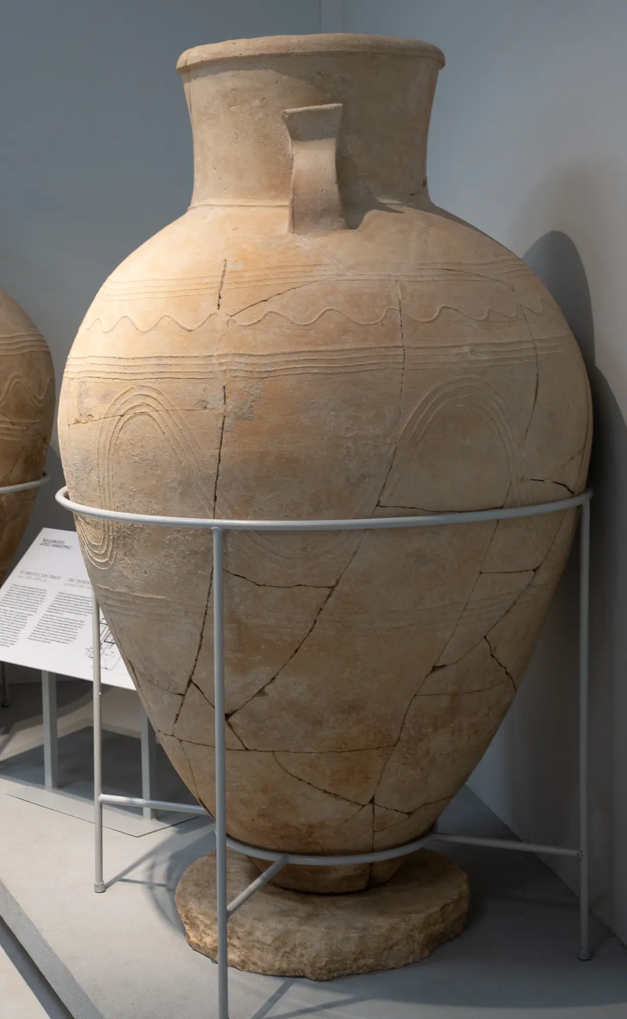
Two sherds from the site, Cyprus Museum 1953/IX-3/6 and 1993/I-20/1, probably from the same vessel, carry an impressed frieze of an Aegeanizing chariot hunt: an archer in a chariot shoots at a bull, a cow and a calf [5, pp. 12–13]. More than thirty-five fragments of such impressed pithoi are known from coastal and inland centres, including Alassa, Analiondas and Athienou, and none is earlier than the thirteenth century BCE [5, pp. 17–18]. The large pithos in the Larnaca District Museum, about 2 m tall, shows the scale these jars could reach.
Webb and Frankel counted "well over a thousand pithos fragments", noted the "absence of decorated domestic wares" and more than two hundred grinding tools, and concluded that Analiondas was "a specialized production centre set apart from domestic installations", and not part of a settlement [5, p. 16]. They think it stored grain rather than oil, and that it was placed to feed the mining communities of the foothills, within a system of "staple finance, whereby mining communities received remuneration directly in the form of food". Imported goods probably reached such sites "down the line" from the centres [5, p. 17].
The contrast with the towns is one of scale. Building X at Kalavasos-Ayios Dhimitrios held about forty-five pithoi in its North Pithos Magazine and about fifty in its Pithos Hall, some 50,000 litres of capacity, with residues pointing to olive oil [5, pp. 16–17]; the building is described under food and diet. Webb and Frankel also observe that south of the Troodos, farming and mining could be run from one primary centre "without recourse to a tiered system" [5, p. 17], a reminder that the hierarchy of the previous section need not have looked the same everywhere on the island.
Rural industry: pottery at Sanidha
Villages made things as well as food. Sanidha lies about 20 km northeast of Limassol, and the Late Bronze Age site of Moutti tou Ayiou Serkou is 1 km northeast of the modern village at an altitude of 520 m. It was found by accident in 1988, excavated as a rescue project in 1990 by Ian Todd of the Vasilikos Valley Project, and investigated again in 1991 and 1992 [6, p. 246].
The surface has the densest scatter of White Slip II pottery known from any Cypriot site, together with wasters. White Slip and Monochrome are present, but "almost none" of Base Ring. The scatter extends over about 675 by 325 m. No kiln was found in place, but some 500 fragments of fired "brick" around one pit may be kiln furniture, and every raw material the potters needed (timber, water, clay and temper) was available locally [6, p. 246]. Sanidha is a rural site given over to one craft and sited beside its raw materials. The way such pottery was fired is covered under pottery kilns and firing, and the site's place in the ware's production under the production of White Slip pottery.
What the villages do not tell us
The rural record ends with the thirteenth century. Aredhiou shows no clear LC IIIA activity [1, p. 517], and Apliki was destroyed between 1200 and 1180 BCE [3, p. 348]. Whether this reflects a general abandonment of the countryside in the twelfth century, or only the history of these particular sites, cannot be answered on present evidence.
Several parts of the picture are still missing. None of the sites described here has produced a complete rural house: Aredhiou's houses were lost to terracing, and Analiondas is a storage site known from survey. The four sites described here are a farm complex, a miners' settlement, a smelting place and a pottery-making site, which fits Steel's point that rural places were multifunctional and varied [1, p. 513]. They also confirm Iacovou's point about size: 0.8 ha at Analiondas, and anything from 2 to 10 ha at Aredhiou depending on what is counted [5, p. 9; 4, p. 572; 1, p. 515]. What connects them is a set of working relationships: grain stored for miners, labour moving with the seasons between field and mine, and fine wares and imports moving down the line from the centres.
Objects on this page
References
- 1.Steel, L. (2016). Exploring Aredhiou: New light on the rural communities of the Cypriot hinterland during the Late Bronze Age. American Journal of Archaeology, 120(4), 511–536. https://www.jstor.org/stable/10.3764/aja.120.4.0511
- 2.Iacovou, M. (2007). Site size estimates and the diversity factor in Late Cypriot settlement histories. Bulletin of the American Schools of Oriental Research, 348, 1–23. https://www.jstor.org/stable/25067035
- 3.Kassianidou, V. (2018). Apliki Karamallos on Cyprus: The 13th century BCE miners' settlement in context. In E. Ben-Yosef (Ed.), Mining for ancient copper: Essays in memory of Beno Rothenberg (Sonia and Marco Nadler Institute of Archaeology Monograph Series 37, pp. 345–356). Nadler Institute of Archaeology, Tel Aviv University.
- 4.Knapp, A. B. (2003). The archaeology of community on Bronze Age Cyprus: Politiko Phorades in context. American Journal of Archaeology, 107(4), 559–580. https://doi.org/10.2307/40024323
- 5.Webb, J. M., & Frankel, D. (1994). Making an impression: Storage and surplus finance in Late Bronze Age Cyprus. Journal of Mediterranean Archaeology, 7(1), 5–26. https://doi.org/10.1558/jmea.v7i1.5
- 6.Todd, I. A. (1997). Sanidha. In E. M. Meyers (Ed.), The Oxford encyclopedia of archaeology in the Near East (Vol. 4, p. 246). Oxford University Press.